Wednesday, May 11, 2016

Amarillo Texas

After leaving Little Rock, Arkansas we headed over to Amarillo, Texas on our way to Colorado Springs, Colorado.  We decided to stay there a week and take in whatever sights there were.

The RV park we decided to stay in was the AOK Camper Park located off of I-40 at Exit 80.  The reason I mention this is that if you are a Passport America member you can stay there for $12.50 a night.  It wasn't fancy, but well worth the price.
Sunrise at AOK Camper Park in Amarillo, Texas.

One of the first things we did was go eat at The Big Texan Steak Ranch which is more of a tourist attraction than steak house, in my humble opinion.  

The atmosphere was great with a band playing songs, everyone was dressed up like cowboys, and the kids get their kid's meals with a cowboy hat.  They will even come get you in a limo and then take you back home, if you like.

Limousines used to pick you up at The Big Texas Steak Ranch.
It is a Route 66 attraction.
If you can eat this 72oz steak, it is yours free!
A look inside the dining room at The Big Texas Steak Ranch.
The prices were a little high and the steaks were not as good as you would have thought.  Misty ordered her's medium well and it came to the table rare.  She had it sent back and it came back just as rare as it was in the beginning.  So we had it taken off the bill since she could not eat it.  I ordered a rib-eye which was OK, but for the price I would have thought it would have been better.

It is worth going there to see it in person, but we would not eat there again since in our opinion the food quality does not warrant the price.

The next thing we went to see was the Cadillac Ranch which is a local work of art or just art.  If you click on the name above, it will take you to a good news story all about the ranch.  We painted LivelyRV.com on a couple of the Cadillacs so that we would be remembered being there for about thirty or forty minutes.  You bring your own spray paint and color them up.  It does not take long for anything you paint to be covered up by other tourists doing the same thing.
The Cadillac Ranch is in view.
Chloe, Courtney, Avery, Ian, Tia, and Ethan at the Cadillac Ranch.
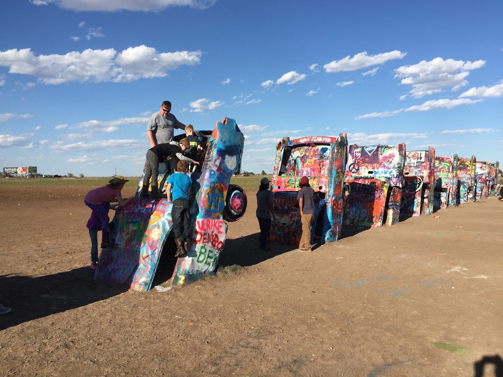
Putting our mark on one of the Cadillacs.
Tia and Avery climbing onto the Cadillac that we branded with LivelyRV.com.
Cadillac Ranch.
Another site we visited was Palo Duro Canyon State Park which is located in Canyon, Texas.  It is claimed to be the second largest canyon in the United States with the Grand Canyon being the only one larger.
Palo Duro Canyon State Park.
Tia, Courtney, Avery, Ethan, Chloe, and Ian at Palo Duro Canyon State Park.
A picture of the famous Lighthouse formation in the park from the visitor's center.
Another picture of the Lighthouse from the visitor center's telescope.
The kids all became Junior Rangers at the park and received their patches.  Unfortunately we did not have time to walk the trail to the Lighthouse formation, but if we ever go back, we will.

Another place we visited while in Amarillo, Texas was the Jack Sisemore RV Museum.  It is located at a RV dealership in the back so when you walk in just say you are there to see the museum.  The admission is free and it has a nice collection of motorcycles, RVs, and other items.  It is worth the trip to kill an hour or two.

You may recognize one of the RVs in the museum as the one in the movie RV with Robin Williams and Jeff Daniels.  If you have never watched it, then you should.  We actually rented it off of Amazon Prime to let the kids watch it.  It is rated PG and if I remember correctly, it was a pretty clean movie.
Ethan, Tia, Courtney, Chloe, Avery, and Ian at the Jack Sisemore RV Museum.
A Harley with a left sidecar.
Just some of the Harleys that are in his collection.


Does the red and white RV look familiar?
It is a 1948 Flxible bus used in the movie RV with Robin Williams and Jeff Daniels.
Some of the pictures from the movie RV.
There was also a mock service station in the museum.
Chloe touring one of the travel trailers in the collection.
Avery behind the wheel in the Flxible.
We also visited the Alibates Flint Quarries National Monument located in Fritch, TX.  This is where the mammoth hunters got the best flint for their weapons over 13000 years ago.

While we were there the kids also earned their Junior Ranger badges, which is always a good way for them to learn some history about the park.

The kids taking the Junior Ranger oath after earning their badges.
I did manage to get some nice pieces of flint while at the quarries, which is not from the actual site, but from surrounding farms who gather it for souvenirs for the park.  It is illegal to pick up Alibates flint from the national park.

I will tumble them to shine them up and maybe make some jewelry out of the best pieces.  That will be another blog though, if I even do it.  So many things to do with so little time.

Alibates flint on the right with stones from Madagascar on the left that are going to get tumbled.

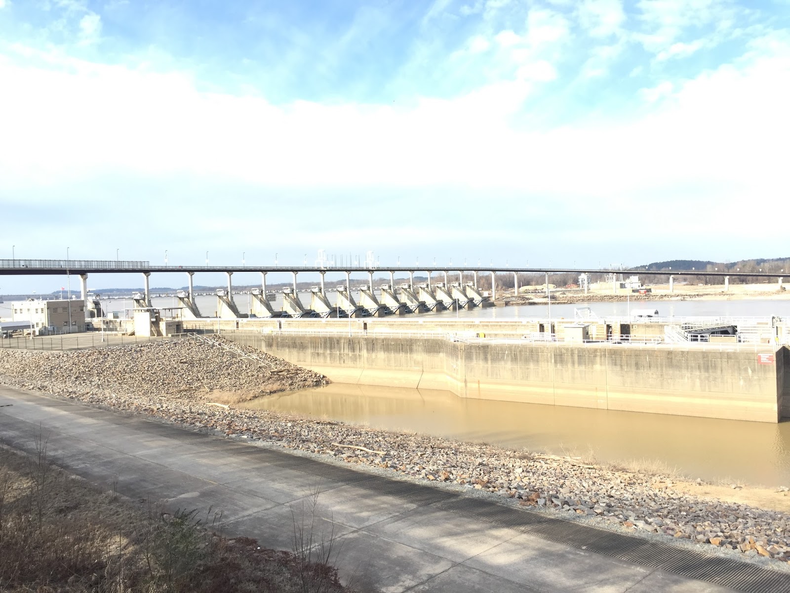
The quarries are located next to Lake Meredith National Recreation Area which at the time was very dry.  The lake is sixty three feet lower than its normal levels.
A picture in Lake Meredith which is located next to the Alibates Flint Quarries.

It was so low that most of the boat launches in the upper part of the lake are bone dry as you can tell from the below picture of our GPS.
Where's the water?
So that was our exploring while in Amarillo Texas, which was quite a bit.  Now we will be heading to Colorado Springs, CO to see what all we can explore there.

We are blessed to be able to travel the way we do and thank God everyday for His blessings and His son Jesus who saved us from our sins.  God bless and safe travels.

Thanks!
Don, Misty, and Kids...
Twenty states visited so far.
 

Thursday, April 7, 2016

More For Little Rock Arkansas

While waiting for our RV to get fixed we ventured out to see some more of the surrounding area and visited Pinnacle Mountain State Park which is just outside Little Rock Arkansas.

The cone shaped peak of the mountain raises above the Arkansas River valley over one thousand feet with two trails available to take you to the summit.  We decided to hike up the West Summit Trail which is 1 1/2 miles long round trip.

West Summit Trailhead.
The sign did state that the trail was steep, rugged, and required strenuous walking, and I would say that it was 100% accurate.  Once you get to the face, it almost requires climbing.  After we made it to the summit, I was thinking maybe it was too much for our five year old daughter and Misty, since she was in the early stages of pregnancy (13 weeks).
Arriving at the West Summit Trailhead.

So far the trail does not look too awfully hard.

So up the mountain we go.  It was a beautiful day for hiking, but the closer we got to the top of the mountain, the stronger the gusts of wind got.  There was a couple of times I questioned our decision of climbing the mountain and wondered if maybe we should turn back, but the kids would not have it.
Ian, Ethan, Avery, Tia, Chloe, and Courtney playing on the rocks while climbing up to the summit.

At this point we are about half way up Pinnacle Mountain to the summit.

The trail is starting to get steeper.

Misty is taking it like a trooper and brining up the rear.


Onward and upward!

It just keeps going.


A beautiful view of Lake Maumelle on the Arkansas River.
At this point we were .3 miles from the summit, but I was thinking maybe we bit off more than we could chew, but we were so close, so we kept trucking on.  Plus the kids were burning off lots of energy, which is always good.
You Are Here

Tia, Courtney, and Chloe taking a break.

Courtney, Tia, Ethan, Don, Ian, Chloe, and Avery.

As we got closer to the top it became apparent that we had our work cut out for us.  What on earth were we thinking?  This is way too much for us to handle!  Push on we must!
Courtney is still smiling.

So are Tia and Chloe while taking a break.

The boys are still climbing and getting too far ahead of us.

Courtney and Misty bringing up the rear.

As we get closer to the top, we can see the parking lot below.

Here is the view from the parking lot up to where the previous picture was taken.
As you can see in the next set of pictures, the trail is getting a lot steeper and treacherous.  Its not like we are scaling Mount Everest, but we do have to be watchful of the kids and where we step, because a fall up here would not end well.

The wind was also blowing which could make you lose your balance and fall which would have been a bad thing.  The unexpected gusts were the worst, because they would catch you off guard.

We were lucky that it was early spring and not hot enough yet for snakes.  I would have to figure they would love all the rocks and if we saw one, then the hike would be over because Misty and Courtney would both probably have heart attacks.
The closer we get to the top, the steeper it gets.

Courtney is holding on so the wind does not blow her away.
Now, in the picture below you have a drop off on the right and the steep trail on the left.  While navigating the mountain, we look over and some of the kids, to include Chloe, were climbing up this narrow ridge to the crest.  I thought Misty was going to have the baby right then and there.

After I recovered from my heart attack, I politely asked the kids to keep to the trail so as not to fall off the mountain.  Of course by politely I mean on the inside, because, you probably could have heard me a mile away screaming at the kids. 

If you will notice the individual at the top of the picture next to the pine tree, you can get a better idea of just how big and steep it is.
The ridge up to the crest of the mountain.

This is what was on the other side of where they were climbing.
The face of the mountain were the kids were climbing next to..

Needless to say, our hearts did skip a beat when we saw where they were climbing.  The thought process of "What in the heck are we doing?" kicked in again, but we are so close to the summit, we just can not quit now.  I've always heard that what does not kill you only makes you stronger or stupider?  I'm not quite sure now.

Finally after a good bit of climbing we made it to the saddle between the two peaks of Pinnacle Mountain.
One of the two peaks on top of Pinnacle Mountain.

The view from top of the mountain.
Avery, Chloe, Dad, Ian, Ethan, Tia, and Courtney on top of Pinnacle Mountain.

Looking down towards the parking lot of the park.

Courtney, Avery, Ethan, Tia, Chloe, Dad, and Ian standing on top of the World.

Don and Misty posing for a well deserved picture on top of Pinnacle Mountain.

The kids taking a break on top of the mountain.

Taking it easy on a natural couch on top of the mountain.

A pantographic view from the top of Pinnacle Mountain.
Now starts the trek back down the mountain, which was harder on us than the climb up.  It was like going down a set of a thousand steps.

Tia and Chloe starting back down the mountain.
All in all it was a good day out with fun and exercise.  No one was hurt while climbing up or down the mountain except for maybe some sore muscles the next day.

Probably the most fun the kids had though was playing at the playground at the bottom of the trails in the park.  We have no idea where the kids had the extra energy stored since our legs felt like jello afterwards and we felt too exhausted to take another step!

Kids having fun playing at the playground.

Once again we are so blessed to be able to see all the places we do as a family and know there are many more places to see before we are done.  God is good to us and keeps us safe in our travels.

We are also blessed with all of the people we meet along the way.  We have met so many good families and individuals on our journey and hope to meet more in the future.

So we survived our Pinnacle Mountain expedition and lived to tell about it.  It is someplace you need to visit if you ever have the time in Little Rock. 

Safe travels and God bless you and all those you love.

Thanks!
Don, Misty, and Kids...
States we have visited so far.

Thursday, March 10, 2016

Big Dam Bridge

While stuck in Little Rock, Arkansas getting our RV worked on, we ventured out to see some of the sights and stumbled upon the Big Dam Bridge which is claimed to be the longest pedestrian bridge in North America at 4226 feet long.
The kids posing at the "big dam bridge".
We parked on the Murray Park side, walked across the bridge to Cook's Landing Park and then back to Murray Park.  It was a nice leisurely stroll with the kids running a head of us burning off their extra energy.  The bridge also spans the Murray Lock and Dam that construction started on in 1964 and finished in 1968.  The lock and dam is the same age as me, if you go by the start date.

Beginning of the bridge from the Murray Park side.

The middle of the bridge over the Murray Lock and Dam.

The other end of the bridge at Cook's Landing Park.
With this being a pretty day in early February, there was a good bit of foot and bike traffic on the bridge.  For the most part there were no issues, but we did have to ensure the kids were not blocking any bikers coming through since they could overtake you quickly.

The bridge spans the Arkansas River which is part of the McClellan-Kerr Arkansas River Navigation System which was completed in 1971.  It is 445 miles long starting at the Mississippi River and ending in Tulsa, Oklahoma. 

Looking west up the river you see Murray Lake, Two Rivers Park, and Pinnacle Mountain which is a state park.  I plan on doing our next blog on our adventure climbing to the top of Pinnacle Mountain, so make sure you check back so you can read it.

Looking up the river towards the I-430 bridge.

Another view of the I-430 bridge with Murray Lake, Two Rivers Park, and Pinnacle Mountain in the background.
Looking east down the Arkansas River towards the Mississippi River which is 125 miles from this location.  The Arkansas River starts in the Rocky Mountains of Colorado and travels 1450 miles until it dumps into the mighty Mississippi.
Looking down stream towards the east.
The bridge also overlooks one of the generators of ten for the North Little Rock Hydro-Electric System.  All of these generators have the potential to produce three billion kilowatt hours of electricity that can sustain power for three million households for average power usage for a month.
Hydro-electric plant at Murray Lock and Dam.
All in all it was nice to get outside and get a little bit of exercise.  I would guess we spent around an hour or an hour and a half walking on the bridge before we loaded back into the van and came back to the RV.

We hope to have all of the body work completed on the RV here soon so that we can leave Arkansas and visit some place where we have not been yet.  It is nice though to be able to visit the attractions in the area, but we have been in this location way too long.

So if find yourself in Little Rock, Arkansas and have time, take it, to visit the longest pedestrian bridge in North America.

God bless and may He keep you safe!

Thanks!
Don, Misty, and Kids...
States we have visited so far.